Area Information > Rock Formations
Anderson Bluff - Springville Township Wisconsin
Anderson Bluff is located in Springville Township of Adams County, Central Wisconsin just south of Springville Assessor's Plat Development / Subdivision. This Bluff is not open to the public the land is privately owned; DO NOT TRESPASS!
Adams County WI Rock Formation
NOTES:
On Private Land
Visable Rocks are unknown.
According to WI GIS Mapping
- Highest Point Above Seal Level is 1,145ft
- About 150ft High
Anderson Bluff Topographical Map
Springville Township WI
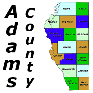
Springville Township is located in Adams County, Central Wisconsin which borders the Wisconsin River to the West. There are several streams that run through this area including; Duck Creek, White Creek, Cornering Creek and a couple unnamed creeks. There not much for public land in this township it's mostly private owned wooded, residential and farmland from small lots to large acreage; also home to Anderson Bluff. Springville is only a couple minutes from the Famous “Wisconsin Dells” where you can find water parks, restaurants, entertainment and lots of events throughout the year. The main intersection is State Highway 13 & State Hwy 82 which is a main road that crosses the Wisconsin River.
Real Estate | Homes | Land | Condos | Multi-Family | Commercial Property
Cities, Towns and Villages
- None
Lakes, Rivers, Creeks and Trout Streams
- Corning Creek - Trout Stream
- Duck Creek
- White Creek
- Wisconsin River
Public Land & Features for the Area
Anderson Bluff
Developments and Subdivision in Adams County WI
- Bakers Valley
- Deer Trails Subdivision (Wisconsin River)
- Fern Acres
- Springville Acres
- Springville Assessors Plat Number 1
- Springville Assessors Plat Number 2
- Springville Assessors Plat Number 3 (Wisconsin River)
- Springville Estates
- The Dells Club Condos (Wisconsin River)


